Aquifer Weekly Water Resource - July 10, 2020
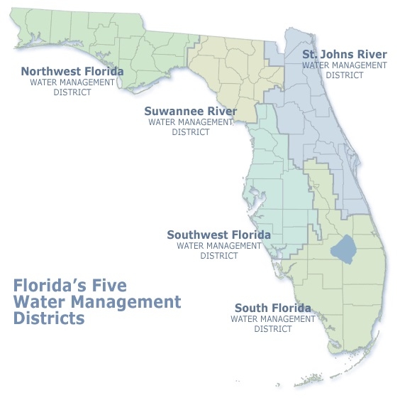
Southwest Florida Water Management District
In southwest Florida, 80% of the water is supplied by aquifers, which are underground layers of rock and sand that hold water.
The local area is within the Southwest Florida Water Management District's *North Region, which includes Citrus, Levy, Marion, Hernando, Sumter and Lake counties.
The North Region's aquifer level (in percentiles) for 2020, as of July 8, was 56% (the previous week was 53%, the same date last year was 81%, and the normal range is 25%–75%).
The North Region's actual rainfall (in inches) for 2020, as of July 8, was 2.79" (the July historic average is 8.25" and the July normal range is 6.76"-9.29"). The year-to-date actual rainfall is 20.29" (the Jan.-July historic average is 31.91" and the Jan.-July normal range is 27.94"-35.72").
The Southwest Florida Water Management District urges year-round water conservation. Water levels may rise and fall, but our water resources remain limited. The District encourages efficient, non-wasteful uses of water to sustain our high quality of life. For more information about ways to conserve water, contact the District at 1-800-423-1476 or visit the District's website at WaterMatters.org.
The North Region's average historic rainfall in inches since 2011 is 53.45, within the normal range of 48.62-58.07. The North Region's historic rainfall in inches for 2019 through 2011: 57.02" in 2019; 66.66" in 2018, 52.41" in 2018, 48.49" in 2016, 52.04" in 2015, 61.12" in 2014, 50.54" in 2013, 55.81" in 2012, and 48.35" in 2011.
*The other regions of Southwest Florida Water Management District include the Central Region (Hillsborough, Pasco, Pinellas and Polk counties), and the South Region (Charlotte, DeSoto, Hardee, Highlands, Manatee and Sarasota counties).
Top
In southwest Florida, 80% of the water is supplied by aquifers, which are underground layers of rock and sand that hold water.
The local area is within the Southwest Florida Water Management District's *North Region, which includes Citrus, Levy, Marion, Hernando, Sumter and Lake counties.
The North Region's aquifer level (in percentiles) for 2020, as of July 8, was 56% (the previous week was 53%, the same date last year was 81%, and the normal range is 25%–75%).
The North Region's actual rainfall (in inches) for 2020, as of July 8, was 2.79" (the July historic average is 8.25" and the July normal range is 6.76"-9.29"). The year-to-date actual rainfall is 20.29" (the Jan.-July historic average is 31.91" and the Jan.-July normal range is 27.94"-35.72").
The Southwest Florida Water Management District urges year-round water conservation. Water levels may rise and fall, but our water resources remain limited. The District encourages efficient, non-wasteful uses of water to sustain our high quality of life. For more information about ways to conserve water, contact the District at 1-800-423-1476 or visit the District's website at WaterMatters.org.
The North Region's average historic rainfall in inches since 2011 is 53.45, within the normal range of 48.62-58.07. The North Region's historic rainfall in inches for 2019 through 2011: 57.02" in 2019; 66.66" in 2018, 52.41" in 2018, 48.49" in 2016, 52.04" in 2015, 61.12" in 2014, 50.54" in 2013, 55.81" in 2012, and 48.35" in 2011.
*The other regions of Southwest Florida Water Management District include the Central Region (Hillsborough, Pasco, Pinellas and Polk counties), and the South Region (Charlotte, DeSoto, Hardee, Highlands, Manatee and Sarasota counties).
